







Photo: Collected
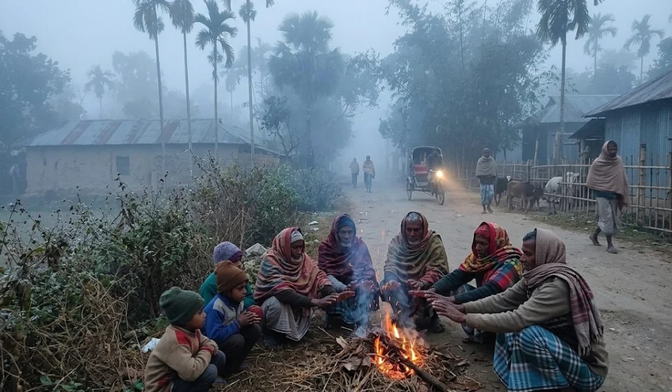
The sun is still strong during the day. But fans are being turned down at midnight and quilts pulled on towards dawn — that is how winter is making itself felt. Its arrival is a little slower in the concrete city, but a chilly wind has started blowing through the villages of the north, where open fields and riverbanks are already wrapped in soft morning fog.
Amid this quiet change of season, the Meteorological Department has delivered a major message about winter. It says 4 to 6 mild to moderate cold waves may sweep across the country over the next three months.
The long-range forecast, covering the period from this November to next January, says the winter may bring several rounds of cold waves. It also mentions the possibility of fog, low pressure and cyclones.
The forecast is signed by Md Mominul Islam, the department’s director (current charge) and chairman of the expert committee on long-range forecasting. It says 4 to 6 mild to moderate cold waves are likely in the three months from November to January, 2 to 3 of which may turn severe.
By the department’s yardstick, a cold wave is mild when the temperature is between 8 and 10 degrees Celsius, moderate between 6 and 8 degrees, and severe when it drops to between 4 and 6 degrees. Below 4 degrees it is a very severe cold wave.
Asked when and where cold waves could be strongest, Meteorological Department meteorologist Dr Muhammad Abul Kalam Mallick told BSS that one or two mild cold waves are usually seen in December. According to him, temperatures in some parts of the north and west — that is, Rajshahi, Rangpur and Khulna divisions — may fall below 8 to 10 degrees Celsius, and mild cold waves may occur there.
He said moderate cold waves are, however, likely in January. At times one or two severe cold waves may also come that month, when temperatures will stay between 4 and 6 degrees Celsius.
During these three months, moderate to dense fog may form from late night to morning in places and over river basins. Elsewhere the fog may be light to moderate.
The forecast notes that dense fog may narrow the gap between day and night temperatures, which will make it feel colder. Overall, however, day and night temperatures may stay above normal during this period.
Explaining why, Dr Abul Kalam Mallick said El Niño is active and the earth is warm, and Bangladesh has felt the touch of it too. The effect will be felt not just in Bangladesh but across South Asia, so average temperatures will be somewhat higher. That is why they are saying temperatures this winter will be above normal. Now and then, however, temperatures will drop below 10 degrees and cold waves will blow.
He said there will certainly be cold waves, but the days, number and extent of very severe cold waves will be much lower. That is why they are saying this winter may be somewhat ‘warm’.
The meteorologist also said that with El Niño active, there is a degree of uncertainty about how many days cold waves will last or how many times they will come, so people need to stay cautious. Overall, though, they hope for a somewhat ‘warm winter’ this time.
Beyond the cold, the forecast also points to the possibility of low pressure and cyclones in the Bay of Bengal. It says 2 to 4 low-pressure areas may form in the sea over the next three months, one or two of which may turn into cyclones.
On this, Dr Abul Kalam Mallick said October and November are cyclone-prone months for the country. Low pressure forms at this time every year, and sometimes it gathers strength and becomes a cyclone.
He explained that the sun’s southward movement is under way at this time. Days gradually get shorter and nights longer, and more sunlight falls along the Bay of Bengal, which raises the sea-surface temperature.
He added that it is a natural process, but it does not happen every year, only now and then. That is why it is called a transient system.
On rainfall, the forecast says the country may get normal rain over these three months. In the division-wise outlook, November’s highest rainfall may be in Chattogram division, at 35 to 40 millimetres. Barishal division may get 30 to 40 millimetres. Dhaka, Sylhet and Khulna divisions may get 15 to 25 millimetres, Mymensingh and Rajshahi divisions 10 to 15 millimetres, and Rangpur division 4 to 8 millimetres.
Rain will fall even less in December and January. In December, Dhaka division may get 8 to 10 millimetres and Sylhet division 10 to 15 millimetres. In January, Khulna division may get 10 to 14 millimetres, and Dhaka and the other divisions 6 to 10 millimetres.
The Meteorological Department said the forecast was prepared by analysing various weather data, upper-air weather patterns, climate models and model forecasts from various international centres approved by the World Meteorological Organization. El Niño and La Niña conditions were also taken into account.
Explaining how long-range forecasts are made, Dr Mallick said an analysis of how many low-pressure areas formed in the Bay of Bengal in October and November from 1948 to 2025 shows that one to three are present on average at this time. Some of them occasionally gather strength. Long-range forecasts are based on such long-term averages.
He also reminded that the level of uncertainty in such forecasts is much higher. The meteorologist therefore advised keeping an eye on regular daily forecasts alongside long-range ones.
Meanwhile, rainfall in October was 68 per cent below normal. The month’s highest temperature was 37.8 degrees Celsius in Sylhet on 17 October. The lowest was recorded at Tetulia in Panchagarh on 27 October, at 15.4 degrees Celsius. Last month the country’s maximum, minimum and average temperatures were 1.8, 0.4 and 1.1 degrees Celsius above normal respectively.
Background
The Meteorological Department also issued a long-range forecast at the start of January last winter. It mentioned five cold waves that month, one of which could be severe — Desh Rupantor reported this on 14 January 2026.
According to an Ittefaq report of 14 January 2026, a cold wave swept Tetulia for nine straight days from 6 to 14 January that time, with minimum temperatures ranging between 6.8 and 9.2 degrees Celsius.
By the numbers
Tetulia also holds the country’s record low: the mercury fell to 2.6 degrees Celsius there on 8 January 2018 — bdnews24.com reported this on 28 January 2024.
Sources
Background sources: Desh Rupantor, 14 January 2026; Ittefaq, 14 January 2026; bdnews24.com, 28 January 2024